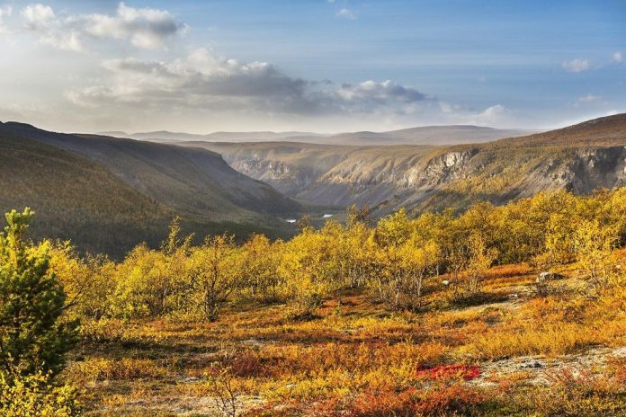
Picture above: View down Reisadalen. The landslide slopes show where the bedrock consists of little-transformed shales and sandstones, while the steep mountain above consists of sliding decks that were pushed in with great force over Troms and Finnmark in Devon.
Reisadalen stretches from the coast of Troms and into the Finnmarksvidda. The Reisa River flows through the valley, which for millions of years has cut itself down through Paleozoic and Precambrian rocks.
Side rivers from the plateau and the mountain meet the Reisaelva in many spectacular waterfalls that plunge into the valley floor. The bedrock in Reisadalen tells a small piece of the country’s geological history.
At the bottom are Precambrian gneisses and granites, and above them is a 200 meter thick layer of late Precambrian and Cambrian shales and sandstones (Dividalsgruppen).
Above them are older rocks (quartzites) that were pushed in over the landscape during the Caledonian mountain range folding in Devonian times. The sedimentary rocks acted as a sliding plane.
The rocks of the Dividal group weather easily and form characteristic landslide slopes under the hard bedrock.
The thin layer of shales and sandstones that Finnmark’s sliding decks slid over can be followed to the south – through Sweden – all the way to the Oslo field.


